Category Archives: research

ERS- satellite image

Data acquisition for landscape monitoring and assessment

Landscape monitoring and assessment involves many different disciplines from the ecological to the social and cultural.Copernicus web site

Innovative methods for data acquisition on landscape and land management have been established due to significant advances in remote sensing and geospatial information science, for example from the EU Copernicus programme.

These include sensor data acquisition, cloud computing and rapid high quality image processing capabilities using tools such as uncrewed aerial vehicles (UAVs or ‘drones’), satellite and airborne-based sensors, as well as Lidar with high spatial, spectral, radiometric and temporal resolutions.

Automatic image orientation, surface reconstruction, scene analysis, change detection, classification and automatic feature extraction with the help of artificial intelligence, spatial statistics and machine learning are also being developed for use with the management of land developments and land use planning.olive trees photo

EU satellites reveal how bio-fertiliser can protect the olive groves of southern Italy

The bacterium Xylella fastidiosa (Xfp) has attacked olive trees in Italy since 2013, with severe impacts. Researchers have used Sentinel-2 satellite data to show that bio-fertiliser is proving effective in restoring the agro-ecosystem where since 2013 the bacterium Xylella fastidiosa (Xfp) has attacked olive trees in Italy,

Sentinel-2 data is part of the European Union’s Copernicus Earth Observation programme, which monitors land and marine environments, atmosphere, climate change, emergency response and security to support EU policy. Find out more 

Non-native species assessment 

Remote sensing can help monitor the colonisation of natural habitats by non-native species. These cause substantial ecological and economic damage. Research in Spain suggests monitoring and response efforts need to be prioritised as the removal of established alien species populations is costly and rarely successful.

The EU’s Invasive Alien Species (IAS) Regulation includes measures to manage established invasive alien species and to reduce the number of Red List species that they threaten by 50% by 2030. Find out more

Using satellite remote sensing to monitor biodiversity richnessforest photo

The presence and abundance of European aspen is a useful indicator of boreal forest biodiversity. The species richness and community composition of epiphytic lichens provide information about the influencing factors in their environment (humidity, tree density and age, light availability and more).

However, intensive forestry practices are causing aspen populations to decline, leading to a subsequent loss of lichen habitat. Find out more

The use of remote sensing methods is increasingly being used to reliably detect patterns and trends in biodiversity, with ‘light detection and ranging’ (LiDAR) and hyperspectral imaging to explore diversity in habitats, plant species and plant characteristics.

Remote sensing was more effective at predicting lichen communities than traditional field methods characterising the suitability of individual trees for lichen growth in Europe’s protected areas and to provide a more efficient way to map possible biodiversity hotspots. Natura 2000 sites map

Summary

Monitoring landscapes is a crucial action especially in times when the impacts of climate change are so significant.

There is a need for expertise in landscape monitoring which is derived from a range of disciplines including geology, ecology, environment, geography, economics, sociology, psychology and history.

These interconnections should be considered essential for monitoring the progress towards achieving the United Nations Sustainable Development Goals (SDGs).

natura-2000 banner

Research shows species diversity around nature reserves relies on landscape features

Species that rely on freshwater habitat are declining in Europe.birds directive picture

Research shows that biodiversity within smaller sites in the European Natura 2000 network is highly impacted by the land use of surrounding areas.

The Birds and Habitats Directives are fundamental to Europe’s nature conservation policy, with the Natura 2000 reserves covering 18% of the EU’s land area and more than 8% of its marine territory.

The network of Natura 2000 reserves aims to protect wild bird species, natural habitats and related rare, threatened or endemic species. However, despite ambitious targets and long-term efforts, biodiversity continues to decline, with 60% of the species protected under the directives continuing to be in an unfavourable conservation status, and 80–90% of floodplains degraded.

mapResearch indicates that river biota and river-related species are impacted by stressors at a larger scale – with catchment and upstream river-bank land use having a bigger impact than conditions within a protected area. However, the importance of the surrounding land outside Natura 2000 sites, and freshwater-related species richness inside the sites, has not yet been widely examined.

The methods applied in this research provide a good example on how to approach designing areas for species conservation, knowing that the wider area is an important consideration. Focusing on habitat conditions outside – as well as inside – existing protected areas, will aid effective conservation of freshwater-related species.

The findings of this study could help inform the identification of areas with a high potential for conservation and restoration, given the surrounding landscape setting. This research is pertinent, as a large number of additional protected areas will be designated under the EU Biodiversity Strategy for 2030, and the upcoming Nature restoration law.restoration initiative logo

The researchers selected 648 special areas of conservation (SACs) in Germany and containing at least 15% of freshwater-related habitat group types – i.e. running water, standing water, wet forest and grass wetland. Habitat conditions within the site were assessed: firstly, by calculating the area of freshwater habitat groups in the sites, secondly the average quality of all the river sections within each site, and lastly the average lake quality for each site – based on habitat surrounding the lake.

Finally, the researchers examined a 0.1-km and 1-km buffer of land surrounding each site, as well as a 5-km upstream area including 0.1 km on either side of the upstream river network. Seven land-use classes were distinguished: urban, cropland, pasture, forest, open (semi-) natural vegetation such as natural grasslands or ‘ruderal’ areas, and wetlands and waterbodies. The researchers calculated the percentage cover, diversity and patchiness in the different buffers for all seven land-use classes.

The conditions inside and outside the sites were statistically analysed alongside the occurrence of the selected species in these sites to establish any features that predicted biodiversity richness.

Freshwater-related species richness in this study was found to depend on land use in the area around each Natura 2000 site.biodiversity

The results showed that biodiversity (particularly birds) was higher in small Natura 2000 sites (less than 151.2 hectares) if the locations were embedded in a wet, diverse, and patchy landscape – due to the provision of additional habitats outside the sites. Given that most Natura 2000 sites in Europe are small, the surrounding habitat conditions and land use potentially influences and affects freshwater-related species in many Natura sites across Member States.

The researchers suggest that additional conservation and restoration areas, which may need to be designated in more intensively used landscapes to meet EU biodiversity targets, should be either large enough or surrounded by areas that are only extensively used, to ensure they efficiently protect freshwater-related species.

Source: Kail, J., Januschke, K., and Hering, D. (2023) Freshwater-related species richness in Natura 2000 sites strongly depends on the surrounding land use besides local habitat conditions. Journal of Environmental Management 340: 118025

rural banner

Rejuvenating the countryside

Over the last 150 years in Europe people have been moving into urban areas from rural regions. This trend continues as rates of urbanisation are predicted to increase to 83.7 % by 2050. As a result of this migration, rural regions are experiencing greater levels of poverty and social decay.

RURALIZATION EU was a project funded under the Horizon 2020 programme seeking to stop the decline of rural areas. The project consortium consisted of 18 partners from 12 different countries, including research organizations and partners looking to implement innovative practices. It concerned targeted interviews with young people in different European countries. These provided information, ideas and suggested responses for policymakers. The project hopes to encourage new people living in the countryside.

This video explains the project

The RURALIZATION project was based on the process of ‘ruralisation’ and how it can change development patterns in rural areas overcoming population and economic decline and generating new opportunities. It aims to initiate new policy-relevant knowledge. It sought to turn rural regions into a vibrant and viable place for future generations by understanding and meeting the needs and aspirations of young people. rural forum image

RURALIZATION had 18 partners from 12 different countries including not only research organizations but also partners that implement innovative practices, such as members of the Access to Land network. This diversity will guarantee a wide range of perspectives and situations thus ensuring the project will formulate solutions and recommendations which respond to the diverse needs and features of rural areas in Europe.

Members of the project team interviewed more than 2 000 young people in 20 regions what their dream future would look like in 15 years time. The survey asked where they want to live, how they want to make a living, what their preferred lifestyle would be.

The project then examined and compared existing policies and the challenges that prevent them taking place in order to establish a roadmap to help attract young people to rural areas.MOOC image

RURALIZATION summarised the main trends affecting the 20 regions covered by the survey and identified some weak signals representing symptoms of change in specific regions. The results showed that young people would like to live in rural areas.

Thirty case studies were undertaken to identify promising access to land practices, covering rural newcomers, new farming entrants and those inheriting land.

A series of 12 policy recommendations were created by RURALIZATION which focused on welcoming generational change, recognising weak signals, promoting agroecology and improving access to land. A handbook for local authorities was produced, specifically discussing access to land as pivotal for rural revitalisation.

A total of 10 pilot actions related to access to land and land stewardship were initiated, investigating how to address issues such as inheritance, agricultural intensification, land speculation, biodiversity, and innovative ownership structures.

The project has also developed a MOOC (Massive Open Online Course) designed for rural development professionals and hosted by Delft University of Technology. The course helps students to analyse trends and dynamics of rural regions and learn to formulate ideas, strategies and actions to boost rural development, with a particular focus on younger generations.

RURALIZATION highlights the rejuvenation potential of rural areas. Find out more 

aerial photo

European Policy Outreach

output 3 image

GEOLAND provides materials and resources to Higher Education students to study how European Landscape Convention (ELC) is implemented and adopted in different EU countries.

The European Landscape Convention seeks to encourage citizens and public authorities to implement policies and measures at local, regional, national and international level.

The purpose is to  protect, manage and plan landscapes throughout Europe.

In the framework of the GEOLAND Project, Policy Outreach is an output that provides a European perspective of this implementation and an indication of the activities undertaken in different partner countries and at different scales . Visit Policy Outreachlandscape map

European implementation of the European Landscape Convention has been coordinated and monitored by the Council of Europe.

Find out more about how  European landscape policies have been established and are monitored.

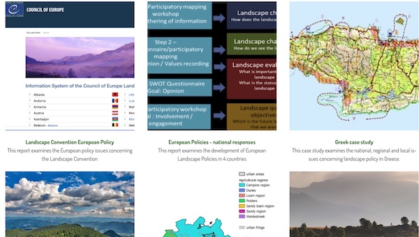
In different countries across Europe the implementation of Landscape Convention policies has varied greatly. Find out more more about national implementation

A series of Case Studies have been created as illustrations of the impact of the European Landscape Convention. Visit the case studies

In this frame, a Policy Outreach Briefing has been developed to assist students in understanding the policy bodies and offer guidelines for interaction. Go to the Policy Outreach Briefing.

banner

Student gallery highlights landscape monitoring results

salt pan photoThe GEOLAND Project has created an online gallery of students’ work on landscape monitoring in NATURA 2000 sites.

This virtual gallery acts  as an educational tool for promoting the training of higher education students in applying the European Landscape Convention and learning about managing effectively the European Landscape.

The gallery also acts as a dissemination tool to showcase efforts in geo-sciences, with the specific objective on forming students competent in decision-making for landscape management, planning and protection of NATURA 2000 sites.satellite image

The outcomes of the students’ work in using GIS in environmental education showcases examples of  relevant studies at partner universities.

The core idea of GEOLAND is to develop experience and expertise in landscape monitoring to take advantage of the opportunities afforded by Cloud-based GIS technology to explore, monitor and evaluate physical, social and cultural landscape attributes..

Undertaking field surveys has been developed using the methodology established and published in GEOLAND Handbook and Technical Annex.

Students gather information, leading to a better understanding of the processes in the area under study. These results allow them to engage in policy aspects adding value to the strategic planning taking place.

In completing these activities, the students learn how to undertake scientific research activities, present their findings, self-evaluate, self-act and self-decide.

Visit the online gallery of student Storymaps

Bulgaria landscape

Landscape Policies : Bulgarian Case Study

The European Landscape Convention seeks to encourage citizens and public authoritieslandscape convention logo to implement policies and measures at local, regional, national and international level for protecting, managing and planning landscapes throughout Europe.

GEOLAND aims to provide resources for to Higher Education students to study how European Landscape Convention (ELC) is implemented and adopted in different EU countries.

This case study examines the national, regional and local issues concerning landscape policy in Bulgaria.

Find out more about the Bulgarian Landscape Award of the Council of Europe

A report on European policy has been produced. Find out about the European Policy Report

landscape picture

Landscapes and rewilding in Europe

On 19 July 2000, the Council of Europe’s Committee of Ministers adopted the European Landscape Convention and decided to open it for signature to the 41 Member States of the Council of Europe.

The European Landscape Convention, also known as the Florence Convention, was the first international treaty to be exclusively devoted to all aspects of European landscape. It aims to fill the legal vacuum caused by the absence, at European level, of a specific, comprehensive reference text devoted entirely to the conservation, management and improvement of European landscapes in the international legal instruments on the environment, regional planning and the cultural heritage.

It applies to the entire territory of the signatories and covers natural, rural, urban and peri-urban areas. It concerns landscapes that might be considered outstanding as well as everyday or degraded landscapes. The Convention is aimed at: the protection, management and planning of all landscapes and raising awareness of the value of a living landscape.

The European Landscape Convention introduced a Europe-wide concept centring on the quality of landscape protection, management and planning and covering the entire territory, not just outstanding landscapes. Through its ground-breaking approach and its broader scope, it complements other work done by the Council of Europe and the UNESCO World Heritage Convention.

Council of Europe Heritage Priorities

coe cultural heritage image

World Heritage Convention timeline

unesco cultural heritage image unesco cultural heritage image

Recent research by Quintera-Uribe and others (2022) suggests that large-scale ecological restoration of the multiple dimensions of landscape is crucial for effective biodiversity conservation and combating climate change. They analyse the main characteristics of participatory scenarios in Europe and suggest going beyond existing participatory activities centred on developing exploratory or target-seeking scenarios. They consider future-seeking scenarios related to ‘Nature for Society’ and ‘Nature as Culture’ and identify gaps for further work. Rewilding landscapes was an important theme in this research.

rewilding europe imageAccording to Harris (2021), rewilding was first discussed in the 1980s as a continental-scale vision to protect large tracts of wilderness and connect these areas with migration corridors. It is now considered to be a shift from human-centred, intensively managed landscapes to humans sharing their lands with the rest of nature.  In Europe rewilding is commonly connected with returning abandoned agricultural land to nature or allowing natural processes, like the coastal erosion of cliffs to take place with protecting them from the waves. Find out more about Rewilding European Landscapes

New initiatives like the Endangered Landscapes Programme are being developed restoring landscapes across Europe. Find out more by playing the video.


map banner

Visualising Climate And Landscape

earthmap imageEarth Map (https://earthmap.org/) is an innovative and free application developed by the Food and Agriculture Organisation of the United Nations. It was designed in the framework of the partnership between the Food and Agriculture Organisation of the United Nations and Google. Earth map facilitates the visualisation, processing, and analysis of land and climate data.

It was created to support countries, research institutes and even farmers with internet access to monitor their land in an easy, integrated and multi-temporal manner.

Earth Map allows everyone to visualise, process and analyse satellite imagery and global datasets on climate, vegetation, fires, biodiversity, geo-social and other topics.

Earth Map’s data is divided into thematic segments – Climate, Geosocial, Vegetation, Land Degradation Neutrality, Water, Satellite images, Land maps, Forestry, Fire, Geophysical, Soil and Biodiversity.

The data allows users to visualise different layers of information to create maps and to generate statistics to describe the areas of interest. These layers include the European Space Agency’s Climate Change Initiative Land Cover, the Copernicus ECMWF Temperature and Precipitation ERA5 data, the Global Forest Change tree cover loss, Nightlights.

Earth Map allows users to access and display information from multiple time periods. It  thereby gives  both a temporal (accessing time series data) and a spatial (visualising places) perspective to their areas of interest.

Users need no prior knowledge of remote sensing or Geographical Information Systems (GIS).

earth map map

Find out more – Visit Earth Map

handbook image

GEOLAND Handbook and Technical Annex available in 6 languages

The GEOLAND project seeks to improve and promote the engagement of Higher Education (HE) institutions, professors and students, in monitoring actions leading to effective decision-making for the implementation of the European Landscape Convention (ELC).handbook cover image

With this in mind the project has published an Educational Handbook and Technical Annex in English, Bulgarian, Dutch, Greek, Italian and Spanish.

These are available for download from https://www.geolandproject.eu/outputs/.

The Handbook includes state-of-the-art information and materials on learning and teaching perspectives, methodologies including citizen science, and Landscape Character Assessment related to the European Landscape Convention.

The Technical Annex complements the Handbook in order to provide details of the five methodological stages important for Landscape Character Assessment (LCA) by using GIS and public participation.

The five stages offer information, advice, resources and tools to carry out a Landscape Character Assessment for Natura 2000 or other sites of interest, are:
i) Purpose definition
ii) Desk-based data collection
iii) Field-based data collection
iv) Classification and
v) Overall evaluation

Training resources are now being developed to support university teachers and academics to implement the approach with their students.


handbook image

Educational Handbook published

The vision of the GEOLAND project is to establish and promote the effective participation of Higher Education (HE) institutions in monitoring actions leading to influencing decision-making for the implementation of the European Landscape Convention (ELC).handbook cover image

With this in mind the project has published an Educational Handbook with state-of-the-art information and materials on learning and teaching perspectives, methodologies including citizen science, and Landscape Character Assessment related to the European Landscape Convention.

The Educational Handbook can be downloaded in English, Bulgarian, Dutch, Greek and Spanish, from https://www.geolandproject.eu/outputs/

A Technical Annex to the Handbook will shortly follow with examples, advice and guidance on the teaching and learning of the five methodological stages for Landscape Character Assessment.

Download a leaflet about the project